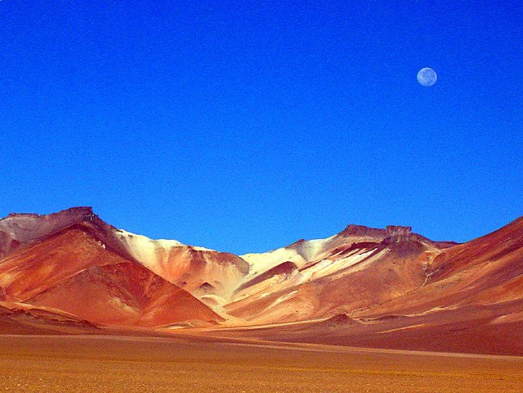
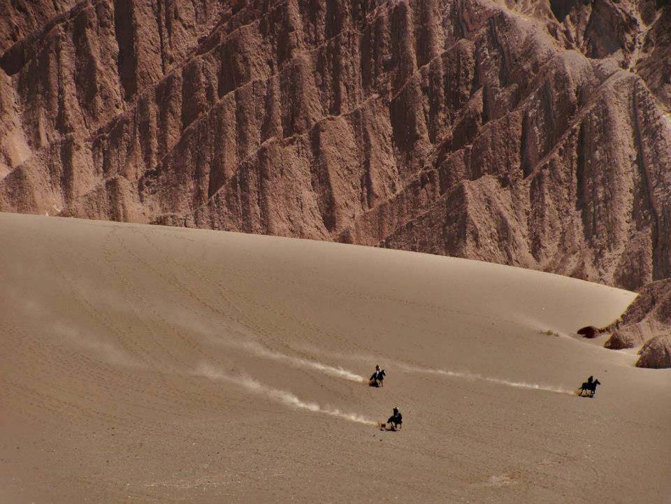
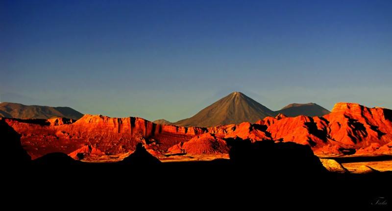
The Atacama Desert (Spanish: Desierto de Atacama) is a plateau in South America, covering a 1,000-kilometre (600 mi) strip of land on the Pacific coast, west of the Andes mountains. It is the driest non-polar desert in the world. According to estimates the Atacama Desert proper occupies 105,000 square kilometres (41,000 sq mi), or 128,000 square kilometres (49,000 sq mi) if the barren lower slopes of the Andes are included.Most of the desert is composed of stony terrain, salt lakes (salares), sand, and felsic lava that flows towards the Andes.
El desierto de Atacama, el desierto no-polar más árido de la Tierra,se extiende en el Norte Grande de Chile —abarcando las regiones de Arica y Parinacota, Tarapacá, Antofagasta, Atacama y el norte de la región de Coquimbo— y cubre una superficie de aproximadamente 105 000 km². Es de tipo costero frío, y está delimitado por el océano Pacífico al oeste y por la cordillera de los Andes al este.
Es una de las ecorregiones de Chile y, además, forma parte de la ecorregión del desierto del Pacífico, que incluye todos los desiertos costeros de Chile y Perú —por su parte, la National Geographic Society considera que la zona costera peruana forma parte del desierto de Atacam

The World Wide Fund for Nature defines the Atacama Desert ecoregion as extending from a few kilometers south of the Peru–Chileborder to about 30° south latitude.[7] The National Geographic Society considers the coastal area of southern Peru to be part of the Atacama Desert[8][9] and also includes the deserts south of the Ica Region in Peru.
Peru borders it on the north and the Chilean Matorral ecoregion borders it on the south. To the east lies the less arid Central Andean dry puna ecoregion. The drier portion of this ecoregion is located south of the Loa River between the parallel Sierra Vicuña Mackennaand Cordillera Domeyko. To the north of the Loa lies the Pampa del Tamarugal.
The coastal cliff west of the Chilean Coast Range is the main topographic feature of the coas
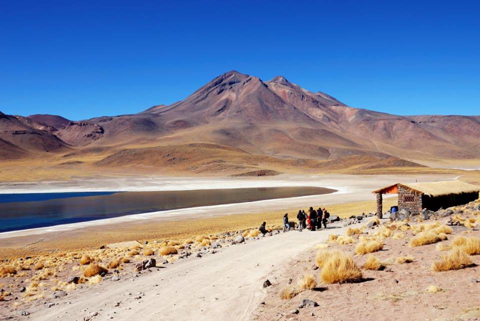
LagunaVerde
Otra parte integrante de este desierto corresponde a una ecorregión denominada puna de Atacama, ubicada sobre los 3500 msnm y que es compartida por la vertiente occidental de la cordillerana de los Andes en el norte de Chile, y por la vertiente oriental de la misma en el noroeste de Argentina y suroeste de Bolivia.
Es rico en recursos minerales metálicos —como cobre (Chile es el mayor productor del mundo y cuenta con el 28 % de las reservas mundiales),hierro, oro y plata— y no metálicos —entre los que destacan importantes depósitos de boro, litio(Chile cuenta con el 39 % de las reservas sudamericanas),nitrato de sodio y sales de potasio—. También se destaca labischofita, una sal de magnesio extraída del salar de Atacama, usada como agente apelmazante en la construcción de caminos. Estos recursos son explotados por varias empresas mineras, como Codelco, la mayor compañía cuprífera del planeta, Lomas Bayas, Mantos Blancos y Soquimich.
Climate
This phenomenon is called the altiplano winter, which can produce a little rain and abundant thunderstorms, and occurs in January and February. In 2012, the altiplano winter brought floods to San Pedro de Atacama.On March 25, 2015, heavy rainfall affected the southern part of the Atacama desert.[16][17] Resulting floods triggered mudflows that affected the cities of Copiapo, Tierra Amarilla, Chile, Chanaral, and Diego de Almagro, causing the deaths of more than 100 people.

Clima
En el desierto de Atacama, una lluvia posible de ser medida —es decir, de 1 mm o más— puede tener lugar una vez cada 15 o 40 años —se han registrado periodos de hasta 400 años sin lluvias en su sector central Sin embargo, la zona se ve afectada entre enero y febrero por el llamado «invierno altiplánico», que produce alguna que otra lluvia y abundantes tormentas eléctricas. Esta zona registra dos récords meteorológicos mundiales. El primero de ellos es que Arica anota el promedio anual de lluvias más bajo del mundo, alcanzando tan solo 0,5 mm —la mayor parte de las precipitaciones cae en forma de lloviznas débiles y aisladas—. El segundo es que Iquique registra la sequía más larga del mundo, con 16 años sin precipitaciones.
En las noches la temperatura fluctúa mucho, pues puede bajar hasta -25 °C en la zona de Ollagüe, mientras que en el día la temperatura se puede situar entre los 25 y los 50 °C a la sombra. No hay mucha diferencia entre el verano y el invierno, porque está situado al límite del trópico de Capricornio. En verano, la temperatura ambiente matinal es de 4 a 10 °C y la máxima puede alcanzar los 45 °C a plena irradiación solar. La radiación solar es muy alta en el espectro ultravioleta, por lo que es indispensable el uso degafas y cremas con protección UV.
La humedad relativa del aire es de apenas un 18 % en el interior, pero muy alta en el litoral, llegando hasta un 98 % en los meses de invierno. La presión atmosférica es de 1017 milibares. Existen temporadas de vientos en tornado o ventiscas cuya velocidad puede alcanzar fácilmente los 100 km/h, generalmente registrados al mediodía. Latopografía de la zona es de gradiente en descenso muy paulatino hacia el mar, pero su altura promedio relativa es de 400-1500
Llamas las mas lindas criaturas / Llamas are just beautiful creature.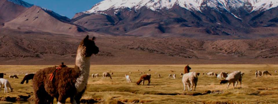
Aridity
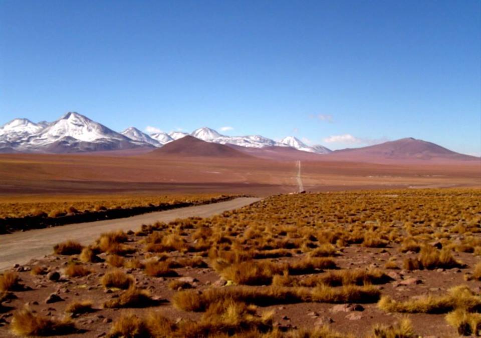
The Atacama Desert may be the oldest desert on earth, and has experienced extreme hyperaridity for at least 3 million years, making it the oldest continuously arid region on earth. The long history of aridity raises the possibility that supergene mineralisation, under the appropriate conditions, can form in arid environments, instead of requiring humid conditions. Geological research suggests that in some sections of the Atacama Desert, such as in today’s Chile, hyperaridity has persisted for the last 200 million years (since theTriassic), competing only with Africa’s Namib Desert for such a title.
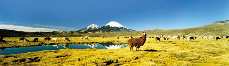
This desert is so arid, many mountains higher than 6,000 m (20,000 ft) are completely free of glaciers. Only the highest peaks (such as Ojos del Salado, Monte Pissis, andLlullaillaco) have some permanent snow coverage.
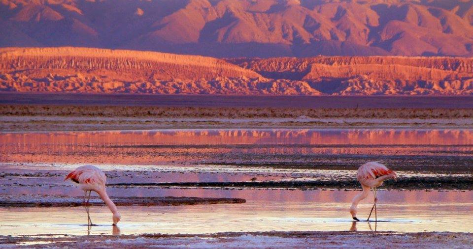
The southern part of the desert, between 25 and 27°S, may have been glacier-free throughout the Quaternary (including during glaciations), though permafrost extends down to an altitude of 4,400 m (14,400 ft) and is continuous above 5,600 m (18,400 ft). Studies by a group of British scientists have suggested that some river beds have been dry for 120,000 years. However, some locations in the Atacama receive a marine fog known locally as the camanchaca, providing sufficient moisture for hypolithic algae, lichens, and even some cacti—the genus Copiapoa is notable among these.
Geographically, the aridity of the Atacama is explained by it being situated between two mountain chains (the Andes and the Chilean Coast Range) of sufficient height to prevent moisture advection from either the Pacific or the Atlantic Oceans, a two-sided rain shadow.

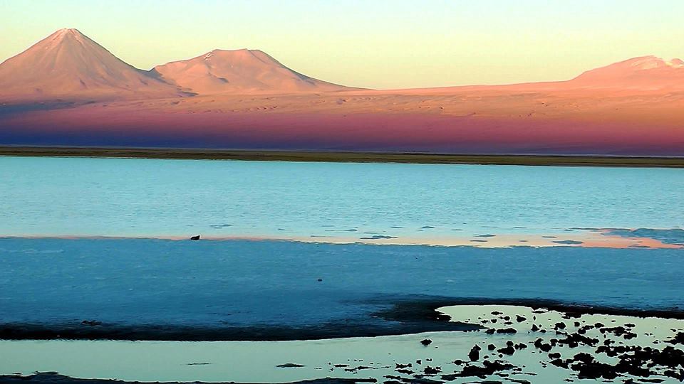
Salar de Atacama

Origen
Su origen data de hace unos tres millones de años, siendo en su pasado un lecho marino. Su cambio se relaciona con la llamadacorriente de Humboldt. La principal causa del origen del desierto de Atacama es un fenómeno climático conocido como efecto Foehn, el cual provoca que las nubes descarguen sus precipitaciones en una cara de la montaña en su ascenso vertical, por lo que, al sobrepasar la cordillera las nubes no poseen agua, generando así un desierto al bloquear por completo todas las precipitaciones posibles provenientes del Oeste, por lo que es la Cordillera de los Andes la que genera el desierto de Atacama al producirse en sus laderas el efecto Foehn. Por el Este, se bloquean también las.precipitaciones sobre el desierto de Atacama mediante sistemas estables de alta presión, conocidos como «anticiclones del Pacífico», que se mantienen junto a la costa, creando vientos alisios hacia el este que desplazan las tormentas.
Por otra parte, la corriente de Humboldt transporta agua fría desde la Antártica o Antártida14 hacia el norte a lo largo de las costas chilena y peruana, que enfría las brisas marinas del oeste, reduce la evaporación y crea una inversión térmica —aire frío inmovilizado debajo de una capa de aire tibio—, impidiendo la formación de grandes nubes productoras de lluvias. Toda lahumedad creada progresivamente por estas brisas marinas, se condensa a lo largo de las escarpadas laderas de la cordillera de la Costa que dan hacia el Pacífico, creando ecosistemas costeros altamente endémicos compuestos por cactus, suculentas y otros ejemplares de flora xerófila.
El último factor que contribuye a la formación del desierto es la cordillera de los Andes, que en el norte forma una planicie volcánica elevada y ancha conocida como Altiplano. Así como en el sur la cordillera andina contribuye a capturar la humedad proveniente del Pacífico, en el norte el Altiplano impide el ingreso a Chile de las tormentas cargadas de humedad provenientes de la cuenca amazónica, que se encuentra al noreste.

Comparison to Mars
In a region about 100 km (60 mi) south of Antofagasta, which averages 3,000 m (10,000 ft) in elevation, the soil has been compared to that of Mars. Owing to its otherworldly appearance, the Atacama has been used as a location for filming Mars scenes, most notably in the television series Space Odyssey: Voyage to the Planets.
In 2003, a team of researchers published a report in the journal Science in which they duplicated the tests used by the Viking 1 and Viking 2 Mars landers to detect life, and were unable to detect any signs in Atacama Desert soil in the region of Yungay. The region may be unique on Earth in this regard, and is being used by NASA to test instruments for future Mars missions. The team duplicated the Viking tests in Mars-like Earth environments and found that they missed present signs of life in soil samples from Antarctic dry valleys, the Atacama Desert of Chile and Peru, and other locales. However, in 2014, a new hyperarid site was reported, María Elena South, which was much drier than Yungay, and thus, a better Mars-like environment.
Towards Atacama, near the deserted coast, you see a land without men, where there is not a bird, not a beast, nor a tree, nor any vegetation.»
La Araucana by Alonso de Ercilla, 1569
In 2008, the Phoenix Mars Lander detected perchlorates on the surface of Mars at the same site where water was first discovered. Perchlorates are also found in the Atacama and associated nitrate deposits have contained organics, leading to speculation that signs of life on Mars are not incompatible with perchlorates. The Atacama is also a testing site for the NASA-funded Earth-Mars Cave Detection Program.


Astronomical observatories
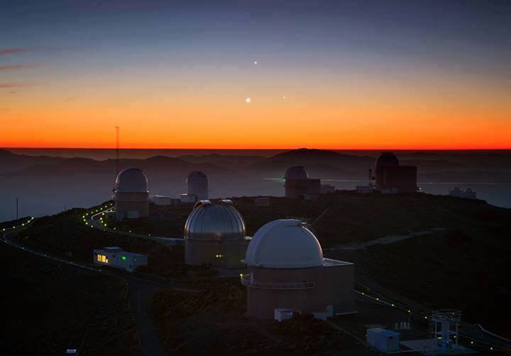
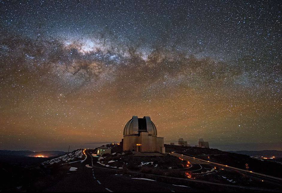
Because of its high altitude, nearly non-existent cloud cover, dry air, and lack of light pollution and radio interference from widely populated cities and town, this desert is one of the best places in the world to conduct astronomical observations. The European Southern Observatory operates two major observatories in the Atacama:
- The La Silla Observatory
- The Paranal Observatory, which includes the Very Large Telescope
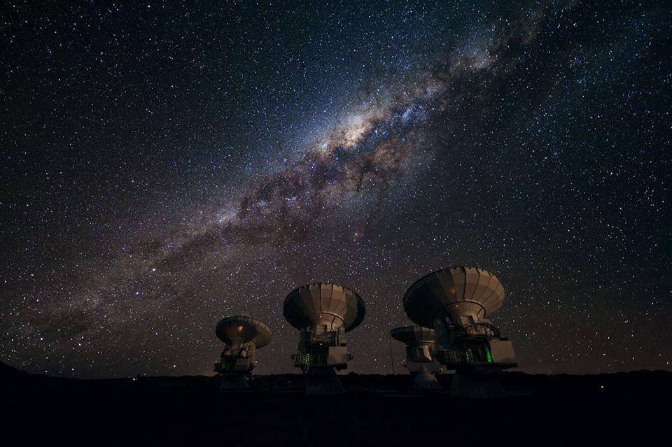
A new radio astronomy telescope, called ALMA, built by Europe, Japan, the United States, Canada and Chile in the Llano de Chajnantor Observatory officially opened on 3 October 2011.A number of radio astronomy projects, such as the CBI, the ASTE and the ACT, among others, have been operating in the Chajnantor area since 1999.